
In the early history of pollution management, big pipe dischargers, especially sewage treatment plants, were an obvious primary target for control. The strong and settled regulatory foundation under the Clean Water Act and the National Pollutant Discharge Elimination System (NPDES) permitting program brought measurable progress, but as the millennium approached, much work remained. The Clean Water Action Plan of the Clinton Administration hit center stage in 1998, with a timely if not overdue refocus on nutrients as a significant and growing cause of eutrophication impairments, especially in estuarine watersheds and systems where I have worked for much of my career. Nonpoint source/stormwater management was boosted by treating MS4s (Municipal Separate Storm Sewer Systems) and certain Confined Animal Feeding Operations (CAFOs) as regulated point sources requiring NPDES permits.
As I reflect on the impact of these programs and the new initiatives emphasizing nonpoint source/stormwater management, I would have to say that water quality improvements attributable to landscape management have been limited. Without question, farming and development compromise functionality of natural landscapes that once sustained healthy ecosystems and the services they provide. To my eye, the problem is fundamentally a binary trade-off between land-cover features that support natural functions and those that exclude them. Human structures and functions don’t leave much operating room for Nature and the impact on the land is proportionately transferred to the water.
The relationship between watershed condition and aquatic ecosystem health is scientifically supported by decades of applied research documented in EPA’s Biocondition Gradient (BCG) Practitioner’s Guide[i]. The more degraded the landscape, the poorer the condition of the aquatic ecosystems from myriad chemical, physical and biological pressures delivered from the watershed. A 50% natural land cover tipping point proposed by E.O. Wilson[ii] necessary to sustain ecosystem functionality and biodiversity is gaining traction as a global management goal,[iii] a level that appears transferable to the local scale.[iv] This may also be a changepoint critical to aquatic ecosystem health[v] provided that 10% of this natural land cover is distributed along sensitive riparian and shoreline buffers.
Watershed condition also aligns land-cover-derived nutrient loads with aquatic biocondition. The less natural cover, the larger the nutrient load, a combined result of the added burden of “new” nutrients human activities contribute, the ecosystem’s loss of functional capacity to treat and retain pollutants and increased delivery efficiency from hardened landscapes. Benchmarking along the BCG provides an effective way to set site-specific loading targets consistent with desired aquatic life use/biodiversity outcomes based on today’s accurate and precise land cover data. In effect, this benchmarking serves as a target, a TMDL, and a watershed management plan all wrapped into one with Nature-based solutions and outcomes for both biodiversity and nutrients.
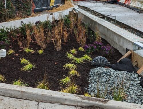
I’m concerned that we’re too glib and confident about our ability to reverse the effects of land-cover degradation using typical Best Management Practices (BMPs). No matter how “green,” most are disconnected from the ecosystem and simply lack the power to shift functional balances that restore biodiversity and broadly support aquatic life designated uses. They cannot compensate for the full suite of ecosystem services, including nutrient “removal,” that characterize highly-functional ecosystems. Frequently, amelioration of a single nutrient pressure is conflated with ecosystem functional restoration, which is unfortunately seldom the outcome. Metaphorically, BMPs only provide life support, dialysis in a setting where the potential for aquatic ecosystem recovery is limited by the condition of the watershed. And the nutrients “removed” by the BMP still lurk in temporary storage and in groundwater, continuously working their way towards surface waters.
While, managers often talk of landscape “restoration,” the process invariably requires a long period of recovery. Recovery is a slow process of healing, occurring on time scales of decades for vegetation, and centuries for soils, but it is the only way to rehabilitate fundamental structural features of healthy watersheds and diverse ecosystems. Realistically, we are also not able to “restore” areas that are irretrievably over-committed to other human uses and lack adequate potential for recovery. In those cases, BMPs provide a mitigative to better align nutrient loads with healthier watershed conditions, but often at a high cost and maintenance burden and a lower-quality outcome. Meanwhile, forest loss continues—at a rate of 10 football fields/day from 1985-2000 in CT[vi] where statewide natural cover still exceeds the 50% tipping point at just below 60%.
In sum, perhaps our most potent management solution is to conserve natural areas and nurture recovery of lands that have the potential to meet desired watershed condition targets for biodiversity and reduce our reliance on less effective BMPs. This is my hope for “Making Nature Great Again” and it is a lofty goal that can only progress as far as people, and Nature, will allow.
—————————————————-
[ii] Wilson, E.O. 2016. Half-Earth. Our planet’s fight for life. Liveright Publishing, New York, NY. 258 p.
[iii] For example, “Earth Needs Half” https://natureneedshalf.org/
[iv] Zipper, S.C. et al. 2020. Integrating the water planetary boundary with water management from local to global scales. Accepted, Peer-Reviewed Article in Earth’s Future. https://agupubs.onlinelibrary.wiley.com/doi/full/10.1029/2019EF001377
[v] For example, Goetz, S.J., et al. 2003. IKONOS imagery for resource management: Tree cover, impervious surfaces, and riparian buffer analyses in the mid-Atlantic region. Remote Sensing of Environment 88 (2003) 195–208.
[vi] Univ. CT, CLEAR – Center for Land Use Education & Research: https://clear3.uconn.edu/viewers/ctstory/
 Paul Stacey
Paul is the owner and principal scientist of a new venture, Footprints In The Water LLC. After many years of state service with the CT DEP and the Great Bay National Estuarine Research Reserve in NH, he is redirecting his efforts to assist management, monitoring and policy decisions that address today’s most pressing concerns – watershed impacts on aquatic ecosystems; effects of climate change; degradation of ecosystems; and conservation of natural assets for the essential services they contribute to the health and value of our society and our ecosystems.